Feeds:
Posts
Comments

Archive for the ‘Finger Lakes’ Category

Tompkins, Cayuga, and Seneca Counties, in partnership with the New York State Department of State and Alta Planning and Design, have completed work on the Draft Cayuga Lake Blueway Trail Plan and are seeking public comment on the draft plan between now and Tuesday, November 12. (Read our story on the Blueway Trail proposal)

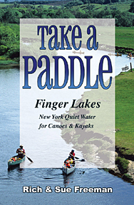
Take A Paddle - Finger Lakes  available at www.footprintpress.com includes West River & more.

Take A Paddle – Finger Lakes available at http://www.footprintpress.com

The National Water Trail System defines water trails as “recreational routes on waterways with a network of public access points supported by broad-based community partnerships”. They provide conservation, recreational, and tourism/economic development opportunities and are focused on boaters, especially paddlers (kayaks, canoes, standup paddleboards, etc.). The Draft Cayuga Lake Blueway Trail Plan identifies the existing conditions along the lakeshore for paddlers; assesses regional assets; identifies gaps in access areas, and proposes locations for short term and long-term improvements and launch sites. It also describes opportunities to market Cayuga Lake as a paddling destination and lays out a variety of possible paddling itineraries, destinations and experiences on the lake for all abilities and preferences, from day trips to multi-day overnight adventures.

Comments can be submitted through the plan’s website directly until November 12th. http://cayugablueway.weebly.com/. Comments may also be submitted via email to Tom Knipe in the Tompkins County Planning Department, tknipe@tompkins-co.org. All comments received by November 12th will be considered as the plan is completed. The Final Cayuga Lake Blueway Trail Plan will be released before the end of the year, and it is expected that a coalition of partners from Cayuga, Seneca and Tompkins Counties will begin work on implementing the Plan in 2014.

source: Ithaca.com, link to original post

Read Full Post »

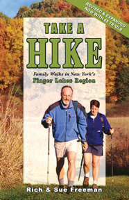
Take A Hike - Finger Lakes available at www.footprintpress.com includes FL Nat'l Forest & more.

Take A Hike – Finger Lakes available at
http://www.footprintpress.com

The Nature Conservancy will dedicate 107 forested acres on Nov. 28 that will become part of the conservancy’s West Hill Preserve. The preserve, which now totals 550 acres, is along Seman Road in the town of Naples, Ontario County, near the southern tip of Canandaigua Lake. Part of the Finger Lakes Trail passes through the property.

Folks from TD Bank, a U.S. banking enterprise owned by a financial corporation based in Toronto, will attend the dedication of the Hickory Ridge parcel. TD Bank has provided funds to pay for this acquisition and other Nature Conservancy work in the Finger Lakes, as a green-minded offset to the bank’s use of tree-consuming paper.

source: D&C

Read Full Post »

The Nature Conservancy & U.S. Fish and Wildlife agreed to remove an old, unneeded dam from Reynolds Gully, a high-quality stream that provides habitat for native brook trout and flows eventually into Hemlock Lake, the near-wilderness lake that provides Rochester with drinking water.

That stretch of Reynolds Gully passes through a 310-acre parcel the conservancy owns near Hemlock Lake, which is in Livingston County about 30 miles south of Rochester.  The group hopes to add the property to Harriett Hollister Spencer State Recreation Area, which lies between Hemlock and nearby Honeoye Lake on Ontario County.

“The project will restore more natural movement of water, better connect the stream to its floodplain and remove an unused structure on the river that is a hazard in times of heavy rain,” the Central and Western New York chapter of the conservancy said in a statement. ““Now, for the first time in more than 50 years, brook trout will be able to travel freely in this stretch of the watershed.”

source: D&C

Read Full Post »

To fully enjoy the sights and smells that autumn in New York has to offer, try walking or biking along a multi-use trail. Take your time as you stroll or pedal your way through a canopy of bright fall foliage, breathing in the fresh air, and drawing in the scenery around you.

Multi-use trails such as rail and canal trails, greenways and bikeways are family friendly places to walk, run, or bike. Many are along historic railways or canal corridors and are mostly flat. Many of the trails are also located near scenic rivers and streams. One thing they have in common, however, is that they all offer a view of the beautiful foliage during the fall months.

Parks & Trails New York has put together a list of Ten Terrific Trails we recommend for fall.

To find a trail near you, use TrailFinder, Parks & Trails New York’s online guide to multi-use trails across New York State at www.ptny.org/trailfinder. TrailFinder can be used to search for trails in several ways—by trail name, by trail attributes such as length, surface, allowable uses, distance from a particular location, or by browsing the interactive map.

Parks & Trails New York is New York’s leading statewide advocate for parks and trails, dedicated since 1985 to improving our health, economy, and quality of life through the use and enjoyment of green space. Find out more about Parks & Trails New York by visiting www.ptny.org and our Facebook and Twitter sites.

Take Your Bike - Rochester available at www.footprintpress.com

Take Your Bike – Rochester available at http://www.footprintpress.com

Erie Canalway Trail – Between Albany and Buffalo more than 270 miles of Erie Canalway Trail provide the opportunity to experience quaint towns and a bounty of fall color along the state’s historic New York State Canal System.  The longest continuous stretch of trail begins in Lockport, about 10 miles east of Buffalo, and continues 100 miles to Lyons along the Erie Canal in western New York.  Other long stretches can be found in the 36-mile Old Erie Canal State Park between Dewitt and Rome in central New York and the more than 40 miles of trail between Little Falls and Amsterdam in eastern New York. When completed, the Erie Canalway Trail will provide 365 miles of multi-use trails along the canal, making it the longest intra-state trail in the country.

Genesee Valley Greenway
– In western New York, the Genesee Valley Greenway’s well-known “tunnel of green” turns to red and yellow as more than 60 miles of trail follows the Genesee River and the abandoned Genesee Valley Canal through woodlands, farmlands, and historic villages from Rochester to near the Pennsylvania border.  Within Letchworth State Park, the Genesee Valley Greenway affords sweeping views of the famous gorge and waterfalls of the “Grand Canyon of the East.”

Take Your Bike - Finger Lakes available at www.footprintpress.com

Take Your Bike – Finger Lakes available at http://www.footprintpress.com

Catharine Valley Trail – The hillsides resplendent with autumn color above Seneca Lake are a perfect backdrop to begin a visit to the Catharine Valley Trail in Watkins Glen.   The 10-mile trail follows abandoned railroad and canal towpath corridors through the 900-acre Queen Catharine Marsh, historic villages, and a heavily wooded, glacially carved valley Located in the heart of the Finger Lakes.

Pat McGee Trail – In the western Southern Tier, the relatively rural 12-mile Pat McGee Trail offers the opportunity to experience the colors of fall while passing through woods, wetlands, and open fields filled with rich a variety of plants, trees, and wildlife.

Cato-Fairhaven Trail – Ponds, wetlands, and old farm buildings add to the rural and agricultural charm of the 14-mile Cato-Fairhaven Trail.  Dense stands of sumac, beech, maple, and aspen trees provide plenty of fall color along this corridor near the shores of Lake Ontario in Central New York.

TOBIE Trail
 
– What better place to experience autumn color than in the Adirondacks.  There are plenty of opportunities to be surrounded by the best of fall foliage from this 12-mile trail that connects the five mountain communities that give the trail its name – Thendara, Old Forge, Big Moose, Inlet, and Eagle Bay.

Catskill Scenic Trail
– The Catskill Scenic Trail follows the route of the former Ulster and Delaware railroad. Young and old will find this an easy and enjoyable route through the foothills of the Catskills.  The trail parallels the West Branch of the Delaware River for the entire route and offers many delightful fishing spots.

Walkway Over the Hudson State Historic Park:  Drink in breathtaking views of the Hudson Valley fully decked out in autumn color from more than 200 feet above the middle of the river on the longest, elevated pedestrian bridge in the world.  The Walkway is the center piece of a 3.6-mile loop that links riverside parks, cultural attractions and historic points of interest on both the Poughkeepsie and Highland waterfronts.

North County Trailway  Following the bed of the former Putnam Division of the New York Central Railroad, this paved trail winds more than 22 miles through the woodlands, parks, and suburbs of Westchester County.  Historic rail stations and a beautiful bridge across the New Croton Reservoir add to the appeal of the route.

Bethpage Bikeway – The 6.5–mile Bethpage Bikeway links Long Island’s Bethpage State Park with the South Shore at Massapequa.  From the Park, the trail passes through a mature forest cover along the Bethpage State Parkway before entering the mixed evergreens and deciduous forests of the Massapequa County Park and Preserve.  The park’s ponds, wetlands, and Massapequa Lake and Creek can all be experienced from the trail.

Read Full Post »

by Michele Accorso | Cardinal Courier, link to original post

Watkins Glen State Park has the type of setting I would expect to see in a fantasy film rather than Upstate New York. This trail is located at the tip of Seneca Lake and is less than an hour and a half away from Rochester, New York. Watkins Glen State Park has a reputation of having the most beautiful scenery and breathtaking views.

200 Waterfalls in Central & Western NY available at www.footprintpress.com (includes Watkins Glen)

200 Waterfalls in Central & Western NY available at http://www.footprintpress.com (includes Watkins Glen)

The park is divided into two sections: the deep shale and limestone glen that the park is known for, and the upper park, which is filled with picnic, camping and recreation facilities. The hike is about two miles long and consists of numerous 200-foot cliffs that generate 19 graceful waterfalls along its course. The gorge path allows hikers to stroll behind these waterfalls and provides a truly amazing view.

Campers and day-visitors can attend scheduled summer tours through the gorge, swim in the Olympic-size pool and spend the night at tent and trailer campsites nearby. Visitors can also picnic or fish near Seneca Lake. The Watkins Glen trail is the center of attention in this city and leads visitors through various cliffs and scenery.

The view of this gorge is beyond anything that I had imagined. I honestly was not expecting such an impressive and break-taking view at Watkins Glen.

The journey begins in the lower parking lot, which is actually where the massive mouth of the glen lies. This trail put me in a world of serenity with calm flowing water, birds singing above, gentle breezes and natural stone.

On the hot summer day I was there, the gorge provided coolness and surprising elegance as I hiked up this long trail.  My favorite aspect of the path at Watkins Glen was a spot called “Lover’s Lane”, which was the most unique scenery I had ever witnessed. At this location, it looked as though the water had torn away at the rocks and made a heart-like shape.

I witnessed many couples taking pictures at this particular spot. As the sun shined on the marvelous aspects of the trail, I had many opportunities to take pictures that would last me a lifetime.

Some of the cliffs were pretty high.  There were a lot of steps, so be prepared if you are terrified of heights! It took me about an hour to hike up the entire thing, but no worries – there is a shuttle to take visitors back to the ground or up to the top if preferred. I would not recommend wearing sandals or flip-flops due to mud or wetness on some parts of the trail, especially the waterfalls.

Aside from the gorge, I tented at one of their campsites. The staff was extremely friendly, helped us carry firewood back to our campsite and provided us with any information we needed.

The camping site was roomy and contained a grill and electricity. The bathrooms were clean and there were many of them around the camp. The Olympic-size swimming pool is definitely worth the time out of a vacationer’s day and the water was clean and clear.

The Seneca area is known for its wineries, and some even offer casual dining and gift shops. There are plenty of ice cream parlors nearby, along with the village’s waterfront park for you to enjoy the scenery.

The Watkins Glen Gorge Trail is the heart of the park and is why people travel there year after year. Although it is tucked away in upstate New York, Watkins Glen is an attraction worth visiting. This camping trip was one of the most enjoyable vacations I had ever taken, so plan a day and visit Watkins Glen!

Read Full Post »

By Rob Montana | Ithaca.com

It’s hard to imagine a place that has as much to offer the outdoor enthusiast in the Finger Lakes as its National Forest.

Wild plums, abundant wildlife and a variety of terrain — plus plenty of place of throw down a tent and spend the night — greet those who enter the Finger Lakes National Forest. There are ponds in which to cool off, miles and miles of trail on which to walk and ride, and even a dedicated campsite for horses and their riders.

Take A Hike - Finger Lakes available at www.footprintpress.com includes FL Nat'l Forest & more.

Take A Hike – Finger Lakes available at
http://www.footprintpress.com includes FL Nat’l Forest & more.

The 16,000-plus acre plot of land between Seneca and Cayuga lakes, the majority of which was consolidated in the period between 1938-1941 when more than 100 farms were acquired under the management of the Soil Conservation Services, became a permanent part of the National Forest system in 1983. The Haudenosaunee originally inhabited the lands that make up the National Forest, but white settlers moved in to farm the land following the Revolutionary War.

But farming became difficult by the turn of the century due to soil depletion and competition from other parts of the country, leading to the federal government’s involvement in acquiring the farmland from individual property owners. Administration of the Hector Land Use Area was turned over to the U.S. Forest Service in the late-1950s, leading to its eventual permanency as part of the U.S. Forest system.

This writer — and family — recently hiked about 3.5 miles of the trails near the Foster Pond area of the Finger Lakes National Forest. Portions of the pathway were wet from recent rainfall — combined with the tamping down of the earth where horses had traveled through previously.

One of the most remarkable things to see was the variety of terrain you pass through in a relatively short span of walking. You can be in a pasture one minute only to find yourself in a seemingly dense wooded area just a few minutes later.

200 Waterfalls in Central & Western NY available at www.footprintpress.com (includes FL Nat'l Forest)

200 Waterfalls in Central & Western NY available at http://www.footprintpress.com (includes FL Nat’l Forest)

Our hike was part of a several day camping trip at the Forest, allowing us to have a day to arrive and set up, spend the night and hit the trail after a hearty breakfast, and to not have to worry about getting back to dismantle our campsite until the following day. Muddy parts aside, the trails are easy to walk along, mostly flat or slight inclines making up the majority of our travels. There were a few steeper inclines, but nothing that remotely resembled an “ascent.”

It was an enjoyable walk in the woods, leisurely enough to stop and pick some blackberries growing alongside the trail during the first part of the walk. We also were able to pick a plethora of wild plums and apples; there are rumors, too, of an ample blueberry patch, but we did not come upon that during this trip.

The start of our hike found us in a lightly wooded area, passing by several ponds, then traveled along pastureland that provided a look at some cows grazing and seeking shade under trees. A steady incline brought us through a gate to the pasture — make sure to close the gates behind you lest some of the bovines get out — and into the deepest portion of woods we encountered. The area potential for the most mud were helpfully covered by bridges installed by volunteers working to make the main trail through the FLNF as easily accessible as possible.

Our hike took place just before the official start of fall, but the leaves had already started to show signs of turning colors. A trip back in the next few weeks is a certainty — just as much of a certainty as the beauty of the fall foliage surely will be.

The bulk of activity in the Finger Lakes National Forest revolves around hiking, whether it is the day variety or those setting up camp as they undertake longer journeys. The trails in the FLNF are pretty well marked — including signs showing the crossings of trails and the amount of mileage to get to other important intersections and points.

The 12-mile-long Interloken Trail runs from the southern end of the Finger Lakes National Forest to the north, passing through various terrain and vegetation.  The southern portions are somewhat steeper and more forested; the northern portions are flatter, more open and travel through pasturelands. It also travels by the Foster and Teeter ponds.

This trail can be wet in the spring and fall, which this writer found to be the case during recent hikes there — particularly in the areas where horses travel creating depressions in the earth that fill up quickly during rainfall. There are outstanding vistas to the west, including views of Seneca Lake.

In addition to the Interloken Trail, which will take between 12-14 hours to hike round-trip, there are seven other Finger Lakes National Forest trails:

The Backbone Trail, 5.5 miles one way, begins at the Backbone Horse Campground. The trail traverses the Forest through shrub-lands, pastures, old roads, and many old homestead sites. It intersects the Interloken and Burnt Hill trails to the south and the No-Tan-Tatko trail to the north. It is a relatively flat, primitive trail with natural tread, gravel in wet places, and traverses through fenced pastures.

The Burnt Hill Trail, 2.5 miles one way, is located on the southern end of the Forest. It includes forests, shrub-lands and pastures, and offers many beautiful vistas along the way. It is a primitive trail with a natural tread. It has gravel in wet areas and traverses through the fenced pastures. The trail intersects the Interloken Trail.

The Gorge Trail, 1.25 miles one way, traverses through Hemlock and hardwood forests, following the gorge between Burnt Hill Road and Mark Smith Road. It is located on the southern portion of the Forest. This trail intersects the Interloken Trail. Gorge Pond is located just east of the Gorge Trail trailhead on Burnt Hill Road.

The No-Tan-Tatko Trail, 4.5 miles one way, is nearly all open pastureland and traverses the Forest in a north/south direction between the Backbone Horse Campground and Parmenter Road. From the Backbone Horse Campground, the trail goes north into Seneca County and crosses the Interloken Trail at Seneca Road. The trail follows Townsend Road east for about 0.5 miles then runs north to the parking area on Parmenter Road. In some of the pastures, there are outstanding vistas, including views of Seneca Lake to the west and Cayuga Lake to the east. The trail is relatively flat, with a primitive trail tread, gravel in wet portions, and mowed grass through fenced pastures.

The Potomac Trail, 2.25 miles one way, travels through a variety of forest types and follows the edges of some of the numerous ponds in the area. This relatively flat trail has a primitive natural tread and traverses occasional wet areas. It is a nice loop on which to learn cross-country skiing and is also a popular game bird hunting area. The Potomac Trail network connects with the Interloken Trail and the Potomac Group Campground reservation area.

The Ravine Trail, 3/4 of a mile one way, passes through Hemlock and hardwood forests. As the trail loops around, it crosses a stream in three places with native rock step crossings. It is a primitive trail with a native tread and is steep in some places. The Ravine Trail connects with the Interloken Trail at Burnt Hill Road.

The South Slope Trail, 3/4 of a mile one way, is located at the south end of the Forest. The trail passes through hardwood and conifer stands and crosses a small stream. It is a primitive trail with plank boardwalk over wet areas. This trail intersects the Interloken Trail, and shares a portion of the Finger Lakes and North Country Trail Systems.

In addition, the Finger Lakes Trail also passes through the forest. Trails that allow horseback riding — Backbone, Burnt Hill, Interloken and No-Tan-Takto — are closed to horses from March 15 through May 1 due to muddy conditions.

Cross country skiing is available on the Backbone, Finger Lakes, Interloken, No-Tan-Takto, Potomac and South Slope trails. Snowmobiling is allowed on sections of the Backbone, Burnt Hill and No-Tan-Takto trails.

Camping at the Blueberry Patch and Potomac Group campgrounds costs $10 per night, while camping at the Backbone Horse Campground is free of charge. People also are allowed to set up a site throughout the Finger Lakes National Forest without a charge, though no camping is allowed within livestock pastures between May 15 and October 31.

For more information about the Finger Lakes National Forest, visit www.fs.usda.gov/fingerlakes or pick up a guidebook from Footprint Press.

Read Full Post »
The 10 Best Fall Biking Adventures Near NYC (& beyond)

Read Full Post »

Take A Paddle - Finger Lakes  available at www.footprintpress.com

Take A Paddle – Finger Lakes available at http://www.footprintpress.com

The CNY Kayakers is a club that brings people together to enhance the pleasure of flat water kayaking. They provide opportunities for all levels of experience, from novice to expert, to share, to learn and to have fun, while navigating the many waterways of Central New York. New this year are Wednesday morning paddles. Click here to learn more.

Read Full Post »

Written by Marci Diehl, Democrat & Chronicle, link to original post
Finger Lakes Land Trust acquires new properties to conserve for nature walks, birding adventuresIt’s some of the most unspoiled, spectacularly beautiful and ecologically important land in the state. And if all goes according to plan, it will be accessible to the public for low-impact uses like hiking, kayaking, fishing and bird-watching.

Take A Paddle - Finger Lakes  available at www.footprintpress.com includes West River & more.

Take A Paddle – Finger Lakes available at http://www.footprintpress.com includes West River & more.

In the past year, the Finger Lakes Land Trust has acquired two important pieces of land overlooking Canandaigua Lake and adjacent to the West River — the lake’s principal tributary — adding to the group’s growing list of acquisitions and conservation easements. The goal is to link a crescent of land extending from Bare Hill southward through South Hill to High Tor and the highlands surrounding Naples.

This is serene land that is teeming with wildlife, forests, waterfalls and flora — and facing watershed and potential erosion problems if developed. The proposal to create a Canandaigua Lake water trail and birding trail could prevent some of these issues for generations to come.

The newest acquisition is a 68-acre property that encompasses a 390-foot cove beach on the east side of Canandaigua Lake, along with extensive woodlands on Bare Hill. Last year, the trust acquired 13 acres adjacent to the entrance to the Bare Hill State Unique Area. And in 2011, Constellation Brands donated 64 acres of an abandoned vineyard in the town of Italy at the south end of the lake — land that the National Audubon Society designated an “Important Bird Area.” Over the summer, the U.S. Fish & Wildlife Service will cultivate native grasses to create a grassland area connecting with the state’s emergent wetlands of the West River.

Take A Hike - Finger Lakes available at www.footprintpress.com includes Bare Hill & more.

Take A Hike – Finger Lakes available at
http://www.footprintpress.com includes Bare Hill & more.

The more that people can see land and experience it, the more connected they become to conserving it, says Andrew Zepp, executive director of the trust. The organization’s goal, he says, is to “work cooperatively with landowners and local communities to maintain the character of this area, while enhancing opportunities for outdoor education and recreation.”

Connecting these preserved lands to the DEC’s High Tor Wildlife Management Area is significant. High Tor’s 6,100 acres encompass habitats, wooded hills, cliffs and marshlands in the West River Valley — along with South Hill’s 1,000 acres of wooded hillsides.

And the West River contains one of the largest wetlands in the state — a popular area for kayakers and canoeists.

Bruce Lindsay has managed 700 acres on the top of South Hill for 43 years, and he sees some species actually returning to former habitats, including porcupines, black bears, coyotes, foxes and wild turkeys.

“Turkey vultures with five-foot wing spans soar above the hill,” Lindsay says. “On rare occasions, eagles are seen here. Goldfinch, blue birds, bobolinks and the rare indigo bunting fill the fields. It’s a birder’s paradise.”

The two southeastern hills of the lake are largely undeveloped. Naples resident Kevin Armstrong donated 32 acres of woodland in the area, on steep property along South Hill above the West River.

“There are many people who would see the land as something to be developed just for the views alone,” Armstrong says.

Lindsay, too, is passionate about protecting this land the Seneca people held sacred.

“In the 21st century, we still have an opportunity to ‘do no harm,’ ” he says. “There are vast areas surrounding this lake that still are pristine. The challenge is to do no harm for the future of pure water, appropriate but not unchecked development, and, yes, just space to enable natural beauty to be the essence.”

Read Full Post »

Ontario Pathways is a linear rail trail. It forms a large “V” with a leg from Canandaigua to Stanley and another leg from Stanley to Phelps. Before reaching Phelps, it passes through the town of Orleans in what’s called the Wheat Road section. The linear trail now has a side loop. Doug Daniels spearheaded a group of volunteers to build the loop tril on land owned by Ontario Pathways between the rail trail and Flint Creek. The new trail is marked by white rectangular blazes.

Take Your Bike - Rochester available at www.footprintpress.com

Take Your Bike – Rochester available at http://www.footprintpress.com

To find the new loop trail, head north on Ontario pathways. From the intersection where the Route 488 bypass (necessitated by the damage to the Route 488 bridge) rejoins the rail trail, look straight across to find the white blazes. The trail will lead down to and along Flint Creek, ending at a farmer’s lane, where you hike back up and rejoin the rail trail.

Take Your Bike - Finger Lakes available at www.footprintpress.com

Take Your Bike – Finger Lakes available at http://www.footprintpress.com

Source: edited from article by Tim Wilbur in the OP newsletter. Tim didn’t mention the length of the new loop trail so if anyone knows, please add it as a comment.

Both “Take Your Bike” guidebooks include Ontario Pathways.

Read Full Post »

Older Posts »