Tompkins, Cayuga, and Seneca Counties, in partnership with the New York State Department of State and Alta Planning and Design, have completed work on the Draft Cayuga Lake Blueway Trail Plan and are seeking public comment on the draft plan between now and Tuesday, November 12. (Read our story on the Blueway Trail proposal)

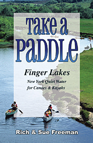
Take A Paddle – Finger Lakes available at http://www.footprintpress.com
The National Water Trail System defines water trails as “recreational routes on waterways with a network of public access points supported by broad-based community partnerships”. They provide conservation, recreational, and tourism/economic development opportunities and are focused on boaters, especially paddlers (kayaks, canoes, standup paddleboards, etc.). The Draft Cayuga Lake Blueway Trail Plan identifies the existing conditions along the lakeshore for paddlers; assesses regional assets; identifies gaps in access areas, and proposes locations for short term and long-term improvements and launch sites. It also describes opportunities to market Cayuga Lake as a paddling destination and lays out a variety of possible paddling itineraries, destinations and experiences on the lake for all abilities and preferences, from day trips to multi-day overnight adventures.
Comments can be submitted through the plan’s website directly until November 12th. http://cayugablueway.weebly.com/. Comments may also be submitted via email to Tom Knipe in the Tompkins County Planning Department, tknipe@tompkins-co.org. All comments received by November 12th will be considered as the plan is completed. The Final Cayuga Lake Blueway Trail Plan will be released before the end of the year, and it is expected that a coalition of partners from Cayuga, Seneca and Tompkins Counties will begin work on implementing the Plan in 2014.
source: Ithaca.com, link to original post


